-
BGP300
Science Communication with Placement
Science communication is a key skill for scientists. Developing these skills allows students to really digest complicated, often abstract theories ideas and find ways to successfully presenting them to non experts. This improves student¿s own understanding as well as equipping them for the much wider world of science and business. Students will learn how to communicate complex science concepts to different audiences using a variety of techniques. Each session of the course will focus onto different modes of communication and will include theoretical and practical components.
The placement portion of this module offers a unique opportunity to develop and practice science communication skills within a professional setting broadly within one of the following themes:
1) Teaching and education
2) Research and industry
3) Public outreach and engagement
Time spent on placements must be between 40 and 60 hours and can take place throughout the term, arranged based on student and host availability (or by agreement with module coordinator, during the Easter holiday where Easter holiday timing permits). Placements are arranged by students themselves but with full support (including list of hosts across all themes, risk assessment, formal placement agreements) from module staff and university Employability team.
-
GEC252ICE
Geographical Fieldwork skills:Iceland - Welsh translation to follow
The module is concerned with identifying and defining geographical questions within a specific field location and applying the relevant geographical skills, knowledge and techniques to these questions. The general aims are to observe, analyse and achieve an understanding of the varied geographical landscapes and inherent features of a designated fieldweek location. The module comprises a week's fieldwork at a designated, normally foreign, location and preparatory and post-fieldweek lectures and other classes.
-
GEC252L
Sgiliau Gwaith Maes Daearyddol: Lleol
The module is concerned with gaining experience of the geographical skills needed to explore the physical and human geography environments around us. We use our considerable local and regional geographical assets to explore multiple themes in human and physical geography. The general aims are to observe, analyse and achieve an understanding of the varied geographical landscape and inherent features in Swansea and South Wales. The module is run via three online 'field days', with a human, physical and mixed human and physical geography theme. Students will be required to complete all three 'field days' and the associated assignments. Students taking this module will gain experience in research design, methodologies, data analysis and presentation methods. Maximum flexibility is afforded by the range of topics we can explore in the local and regional area. The theme of the trip is "South Wales: Environments, Landscapes, Heritage and Community
Welsh translation to follow
-
GEC367
Dulliau Daearyddol a Dadansoddi Data
The dissertation is an original, substantive and independent research project in an aspect of Geography. The dissertation research project is based on 20 - 25 days of primary research (e.g fieldwork, lab work, archive work) and several months of analysis and write-up. The end result must be less than 8000 words of text. The dissertation offers you the chance to follow your personal interests and to demonstrate your capabilities as a Geographer. During the course of your dissertation, you will be supported by a peer-led discussion group and a staff supervisor. Lectures and guidance are delivered via this module as well as peer and staff led Dissertation Support Groups. Participating in Dissertation Support Groups is vital, and is assessed and, in these groups, students will provide constructive criticism to fellow students undertaking related research projects, learning from their research problems and subsequent solutions.
-
GEG100C
Sgiliau Daearyddol
Bwriad y modiwl hwn yw cyflwyno myfyrwyr i sgiliau daearyddol craidd. Bydd y sgiliau gwerthfawr yma yn cael eu meithrin trwy gydol eu gradd ym Mhrifysgol Abertawe. Dylai myfyrwyr sy'n dilyn y modiwl gallu defnyddio'r technegau hyn i ddehongli a dadansoddi data o amrywiaeth o amgylcheddau a chyd-destunau. Trafodwyd sgiliau cyflwyno megis defnydd tablau a chreu mapiau.
(The aim of this module is to introduce the participants to essential geographical skills.These invaluable skills will become enhanced throughout their degree at Swansea University. Participants should be able to apply these techniques to data from a wide variety of environments and contexts. Presentation skills will be covered from the use of tables to the drawing of maps.)
-
GEG133
Natural Hazards and Society
This module investigates hazardous aspects of Earth¿s natural environment and how society relates to them. Introductory principles include the definition of natural hazard, disaster, risk and loss, and approaches to reducing risk and managing disasters. Major types of natural hazard are studied in order to understand how they operate, where, and how frequently they are likely to occur. Hazardous consequences are explored, as well as how society can respond to hazardous events. Key aspects include discussion of primary and secondary hazards, prediction, forecasting and monitoring of hazards, and understanding how their harmful effects can be minimised.
Natural hazards considered during this module include volcanic eruptions, earthquakes, tsunamis, wildfires, landslides, extreme weather events, flooding, avalanches and Mega Hazards. Lecture material considers general principles as well as case studies. The module is compulsory for students taking BSc Environmental Geoscience.
-
GEG133C
Peryglon Naturiol a Chymdeithas
Bydd y modiwl hwn yn ymchwilio i agweddau peryglus amgylchedd y Ddaear a pherthynas y gymdeithas â nhw. Bydd egwyddorion cychwynnol yn cynnwys diffiniad o berygl naturiol, trychineb, risg a cholled ac ymagweddau at leihau risg a rheoli trychinebau. Mae¿r prif fathau o berygl naturiol yn cael eu hastudio er mwyn deall sut maent yn gweithredu, ble, a pha mor aml maent yn debygol o ddigwydd. Caiff canlyniadau peryglus eu hystyried, yn ogystal â sut gall y gymdeithas ymateb i ddigwyddiadau peryglus. Mae agweddau allweddol yn cynnwys trafod peryglon cynradd ac eilradd, rhagweld a monitro peryglon, a deall sut y gellir lleihau eu heffeithiau niweidiol. Bydd y peryglon naturiol a fydd yn cael eu hystyried yn y modiwl hwn yn cynnwys ffrwydradau llosgfynyddoedd, daeargrynfeydd, tswnamïau, tanau gwyllt, tirlithriadau, digwyddiadau tywydd eithafol, llifogydd, cwympfeydd eira a Pheryglon Mawr. Bydd y modiwl hefyd yn ystyried y cysyniad o ¿Bobl fel Peryglon¿. Bydd darlithoedd yn ymdrin ag egwyddorion cyffredinol ynghyd ag astudiaethau achos. Bydd dosbarthiadau ymarferol yn atgyfnerthu¿r cysyniadau a drafodir mewn darlithoedd. Bydd agwedd ymarferol y gwaith hwn yn dod i uchafbwynt mewn diwrnod efelychu rheolaeth mewn trychineb.
This module investigates hazardous aspects of Earth¿s natural environment and how society relates to them. Introductory principles include the definition of natural hazard, disaster, risk and loss, and approaches to reducing risk and managing disasters. Major types of natural hazard are studied in order to understand how they operate, where, and how frequently they are likely to occur. Hazardous consequences are explored, as well as how society can respond to hazardous events. Key aspects include discussion of primary and secondary hazards, prediction, forecasting and monitoring of hazards, and understanding how their harmful effects can be minimised.
Natural hazards considered during this module include volcanic eruptions, earthquakes, tsunamis, wildfires, landslides, extreme weather events, flooding, avalanches and Mega Hazards. The module will also consider the concept of ¿Humans as Hazards¿. Lectures consider general principles as well as case studies. Practical classes reinforce concepts learned in lectures. The practical aspect of the work will culminate in a disaster management simulation day.
-
GEG135C
Cynaliadwyedd a'r Argyfwng Hinsawdd
Bydd y modiwl hwn yn gyflwyniad i newid amgylcheddol byd-eang a bydd yn ystyried agweddau ar
gynaliadwyedd fel pwnc sy¿n effeithio ar fywydau bob dydd. Mae her cynaliadwyedd yn sylweddol a bydd y darlithoedd yn eich darparu â¿r wybodaeth a fydd ei hangen arnoch i ymwneud â Nodau Datblygu Cynaliadwy¿r Cynaliadwy.
This module is an introduction to global environmental change and explores aspects of the issue of sustainability as it affects everyday lives. The challenge of sustainability is significant and the lectures will provide you with the information needed to engage with the UN's Sustainable Development Goals.
-
GEG140C
Dulliau Maes
(Welsh translation to follow)
This module provides training in key practical skills and concepts of field data collection for geology, human and physical geography students.
The module consists of two parts, each of which comprises 50% of the module mark. The first is common to all students, and the second is determined by the student¿s degree specialism (human geography, physical geography or geology).
Main component - common to all students
Here we learn skills and concepts that are fundamental to your geography degree and aim to begin to prepare you for fieldwork aspects of your dissertation project. These include mapwork skills, awareness of data uncertainty, and applying geographical knowledge to real world situations.
Next we will look at sea-level change and its impacts on communities and ecosystems. During classroom sessions we will consider the causes of sea-level change and how it is measured. We use the technique of Stakeholder Analysis to look at the economic and social impacts of sea-level change in different regions. We will then undergo local visits to explore the potential impacts of sea level to our locality and on our coastal university. We¿ll look at both urban and rural environments and different mitigation policies that may be used.
Degree specialisms
Human Geography
The human geography project focusses on Cities and Photography. Students will investigate the use of photography through three Visual Methodologies: Photo-Documentation, Photo-Elicitation, and Photo-Essays. Students will take part in a photo documentation workshop and group photography fieldwork in Swansea City Centre. They will also complete a photo essay aided by group discussion to select concept, theme, whether analytical or evocative photographs (or both), and discussion of the links between practice and visual methodologies literature.
Physical Geography
Students will expand and apply their previous knowledge to natural sea defences (dunes), and learn about assessment of dynamic landscapes over time using three dimensional analysis techniques. They will also contribute to a citizen science initiative for coastal transition zones at risk from sea level change at our University Bay Campus. Using data collected and analysed during the semester, students will gain insight into sources of uncertainty among datasets, enabling them to critically examine the concept of ground 'truth'.
Geology
The module develops geological fieldwork skills through 2 intensive day field classes and one intensive field weekend (Friday and Saturday). Field classes will introduce key aspects of geology in the field, including a variety of rock types, folds and faults, fossils and field relations, as well as developing skills such as keeping a field notebook, making a field sketch, using a compass-clinometer to measure rock surface orientations, manipulation of structural data, sediment logging and correlation and lateral variation. This collected field data will be assessed through a geological report in order to synthesize this field data.
-
GEG250C
Prosesau Rhewlifol ac Afonol
Mae'r modiwl hwn yn archwilio prosesau geomorffolegol a hydrolegol sylfaenol allweddol sy'n gweithredu mewn dalgylchoedd daearol sy'n ymestyn o fynyddoedd i aberoedd, yn benodol yn gysylltiedig â rhewlifoedd ac afonydd. Bydd y modiwl yn archwilio prosesau sy'n gweithredu yn yr amgylcheddau hynny ar wahân yn gyntaf, cyn ystyried sut y gallant ddylanwadu ar beryglon daearyddol, a ffurfiant ac esblygiad tirffurfiau a thirweddau. Nodau'r modiwl yw:
¿ datblygu ymwybyddiaeth gysyniadol drylwyr o weithgaredd a phrosesau rhewlifol ac afonol a chanlyniadau geomorffolegol symudiad d¿r ar draws y dirwedd.
¿ datblygu ymwybyddiaeth gysyniadol feirniadol o'r prosesau sy'n dylanwadu ar sut mae dalgylchoedd yn ymateb yn hydrolegol ac yn geomorffolegol i newid amgylcheddol.
¿ defnyddio dealltwriaeth o dirweddau afonol a rhewlifol i werthuso strategaethau rheoli a fabwysiadwyd ar gyfer sianeli afonydd a dalgylchoedd ehangach, gan gynnwys ar gyfer peryglon hydrolegol.
This module examines key fundamental geomorphological and hydrological processes operating in terrestrial catchments extending from mountains to estuaries, specifically associated with glaciers and rivers. The module will first examine process operating in those environments separately, before considering how they can influence geohazards, and landform and landscape formation and evolution. The module aims to:
¿ develop thorough conceptual awareness of glacial and fluvial activity and processes and the geomorphological consequences of the movement of water across the landscape.
¿ develop a critical conceptual awareness of the processes that influences how catchments respond hydrologically and geomorphologically to environmental change.
¿ utilise understanding of fluvial and glacial landscapes to evaluate management strategies adopted both for river channels and wider catchments, including for hydrological hazards.
-
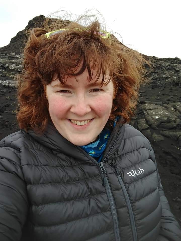
GEG252ICE
Geographical Fieldwork skills : Iceland
The module is concerned with identifying and defining geographical questions within a specific field location and applying the relevant geographical skills, knowledge and techniques to these questions. The general aims are to observe, analyse and achieve an understanding of the varied geographical landscapes and inherent features of a designated fieldweek location. The module comprises a week's fieldwork at a designated, normally foreign, location and preparatory and post-fieldweek lectures and other classes.
-
GEG277HC
Dulliau Daearyddol a Dadansoddi Data – Dynol
This core 20-credit module introduces a variety of human geography research methods, along with data analysis. The module builds upon student knowledge and covers research design, data collection and data analysis. Students are introduced to a range of research techniques in human geography along with statistical analysis. They gain experience in describing, interpreting and presenting the results.
-
GEG277PC
Dulliau Daearyddol a Dadansoddi Data – Ffisegol
This core module introduces a variety of environmental and physical geography methods, along with data analysis. The module builds upon student knowledge and covers research design, data collection and data analysis. They gain experience in describing, interpreting and presenting the results.
-
GEG278C
Sgiliau Dadansoddi Data aPharatoi Traethawd Hir
Mae¿r modiwl hwn yn adeiladu ar wybodaeth y myfyrwyr am ddulliau ymchwil gymdeithasol a dulliau amgylcheddol (a addysgir yn GEG277) i lunio cynnig am draethawd estynedig. Mae¿r modiwl yn canolbwyntio ar sgiliau allweddol i gynllunio a pharatoi am draethawd estynedig a gyflwynir ar y cyd â¿r Ganolfan Llwyddiant Academaidd, megis rheoli amser, meddwl yn greadigol ac yn feirniadol a datblygu ffocws, ysgrifennu cynnig etc. Mae¿r modiwl yn canolbwyntio hefyd ar ddadansoddi data ansoddol a meintiol a sut i ddefnyddio data¿n effeithiol wrth baratoi am brosiect traethawd estynedig yn y flwyddyn olaf.
This module builds upon student knowledge of social research methods and environmental methods (delivered in GEG277) through to the formulation of a dissertation proposal. The module focuses on key dissertation planning and preparation skills delivered in association with the Centre for Academic Success (CAS) such as time management, creative and critical thinking and developing a focus, writing a proposal etc.The module also focuses on qualitative and quantitative data analysis and how to use data effectively in preparedness for a final year dissertation project.
-
GEG367C
Adroddiad Traethawd Estynedig: Daearyddiaeth
Mae'r traethawd hir yn brosiect ymchwil gwreiddiol, sylweddol ac annibynnol sy'n ymdrin ag agwedd ar Ddaearyddiaeth. Mae prosiect ymchwil y traethawd hir yn seiliedig ar 20-25 niwrnod o ymchwil sylfaenol (e.e. gwaith maes, gwaith labordy, gwaith archif) a sawl mis o ddadansoddi ac ysgrifennu. Rhaid i'r canlyniad terfynol fod yn llai nag 8,000 o eiriau o destun. Mae'r traethawd hir yn cynnig cyfle i chi ddilyn eich diddordebau personol ac i ddangos eich galluoedd fel Daearyddwr. Yn ystod eich traethawd hir, byddwch yn cael eich cefnogi gan gr¿p trafod dan arweiniad cyfoedion a goruchwyliwr sy'n aelod o staff. Mae darlithoedd ac arweiniad yn cael eu cyflwyno drwy'r modiwl hwn yn ogystal â Grwpiau Cymorth Traethawd Hir dan arweiniad cyfoedion a staff. Mae cymryd rhan mewn Grwpiau Cymorth Traethawd Hir yn hanfodol, ac yn cael ei asesu ac, yn y grwpiau hyn, bydd myfyrwyr yn darparu beirniadaeth adeiladol i gyd-fyfyrwyr sy'n ymgymryd â phrosiectau ymchwil cysylltiedig, gan ddysgu o'u problemau ymchwil nhw a'u hatebion dilynol.
The dissertation is an original, substantive and independent research project in an aspect of Geography. The dissertation research project is based on 20 - 25 days of primary research (e.g fieldwork, lab work, archive work) and several months of analysis and write-up. The end result must be less than 8000 words of text. The dissertation offers you the chance to follow your personal interests and to demonstrate your capabilities as a Geographer. During the course of your dissertation, you will be supported by a peer-led discussion group and a staff supervisor. Lectures and guidance are delivered via this module as well as peer and staff led Dissertation Support Groups. Participating in Dissertation Support Groups is vital, and is assessed and, in these groups, students will provide constructive criticism to fellow students undertaking related research projects, learning from their research problems and subsequent solutions.