Our Current Facilities
The group is equipped with state-of-the-art high performance computing facilities, experimental facilities and field measurement equipment.
The group is equipped with state-of-the-art high performance computing facilities, experimental facilities and field measurement equipment.
Members of the group have access to the Supercomputing Wales High Performance Computing cluster which enables advanced computational modelling of coastal hydro and morphodynamics, hydrometeorological modelling and CFD modelling of marine energy devices.
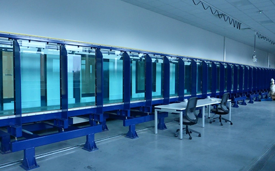
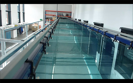
The Coastal Engineering laboratory, located in Bay Campus houses a 30 mx0.8 mx1.2 m wave flume which provides facilities for testing wave forces on coastal structures, nearshore hydrodynamics, wave runup and overtopping, nearshore sediment transport and marine renewable energy devices. The flume is equipped with a piston type random wave generator with active wave absorption, which can generate wave heights up to 0.45m. The facility also has wave gauges, Particle Image Velocimetry (PIV) system, Laser Doppler Anemometer (LDA) and a bed profiler.
The group has a range of equipment for the survey of coastal morphology and measurement of oceanographic parameters including two Datawell Directional Waverider mkIII buoys which are deployed of the coast of South Wales measuring wave conditions including spectra. We have a range of small pressure transducers that can easily be deployed for measuring wave and tidal conditions in the nearshore. The group has a Valeport current meter and a Nortek Vector ADV for measuring currents.
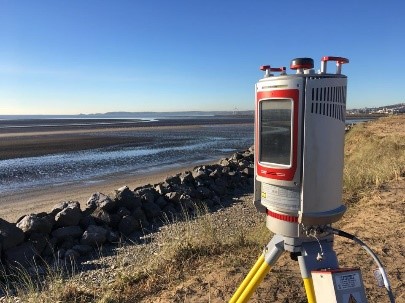
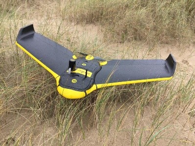
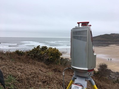
For topographical measurements we have an RTK-GPS, an eBee-RTK drone and a Riegl vZ4000 long range terrestrial laser scanner. The vZ4000 has a range of 4km and an internal camera to allow colourisation of laser return points. The eBee RTK drone is a fixed wing, battery powered drone with a downward facing still camera. Pre-programmed flights collect image data which can be processed to provide topological information. Members of the group have the relevant Civil Aviation Authority qualifications and permissions to conform with commercial drone use regulations.
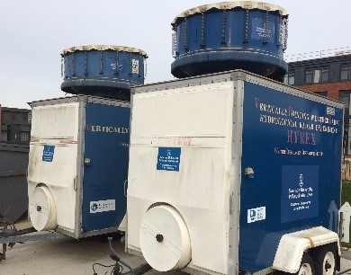
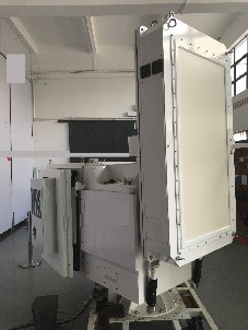
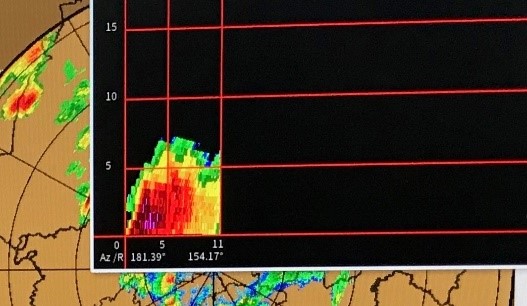
We are proud to be the only UK research group that is equipped with various specialized precipitation observation devices: a conventional C-band rain radar; two bespoke, mobile X-band Vertical Pointing Radars (VPRs) one of which can also be fitted horizontally. In addition, we are working with our industrial partner to design and develop next-generation, high-resolution, dual-pol and phase array radars to for urban flood monitoring and forecasting.
The group holds an agreement with the UK Met Office to carry out hydrometeorological modelling research in association with its cutting-edge UKV NWP platform. We have developed an HPC-based, coupled modelling system that is able to simulate hydrometeorological process from a small catchment size up to a global precipitation/wind/runoff simulation at a stunning resolution of 25 km.